
Pearl City Block Lookup Sources
No official source acts as a household roster for a Pearl City block. Instead, each record answers one narrow question. HoLIS shows the shape and placement of lots. RPAD adds parcel and assessment facts. BOC records transfers for a chosen property, while DPP permits document work. Election sources define districts but protect most registration details. Civic records show public issues, testimony, and organizations rather than private membership.
| Official source | What it adds to the block | Access path |
|---|---|---|
| HoLIS parcel map | Adjacent lots, TMK, address label, regulatory context | Free public viewer |
| Honolulu RPAD | Situs, mailing field, assessed parcel facts, sales references | Address or TMK search |
| Bureau of Conveyances | Title transfers and legal descriptions for one chosen parcel | 1976+ online; older request |
| DPP records | Permits and changes tied to TMK | Historic snapshot; current office request |
| Election records | District, precinct, and limited public voter status fields | Law and official precinct tables |
| Neighborhood Board 21 | Meetings, testimony, issues, and civic contacts | Agendas, minutes, event pages |
Ownership and occupancy are not synonyms. A mailing address may belong somewhere else. Renters and other household members may never appear on a parcel card. Use the official record only for the point it actually establishes.
Select a Pearl City Parcel
Open the Honolulu parcel selector and locate the target by address or TMK. The public interface shows current tax parcel, current regulatory parcel, current address ID, and current address label. Search modes also include TMK and point of interest. Copy the displayed identifiers before zooming out.
The captured GIS page below shows the public entry used for Pearl City block research. It is a map-to-parcel bridge, not a person search.
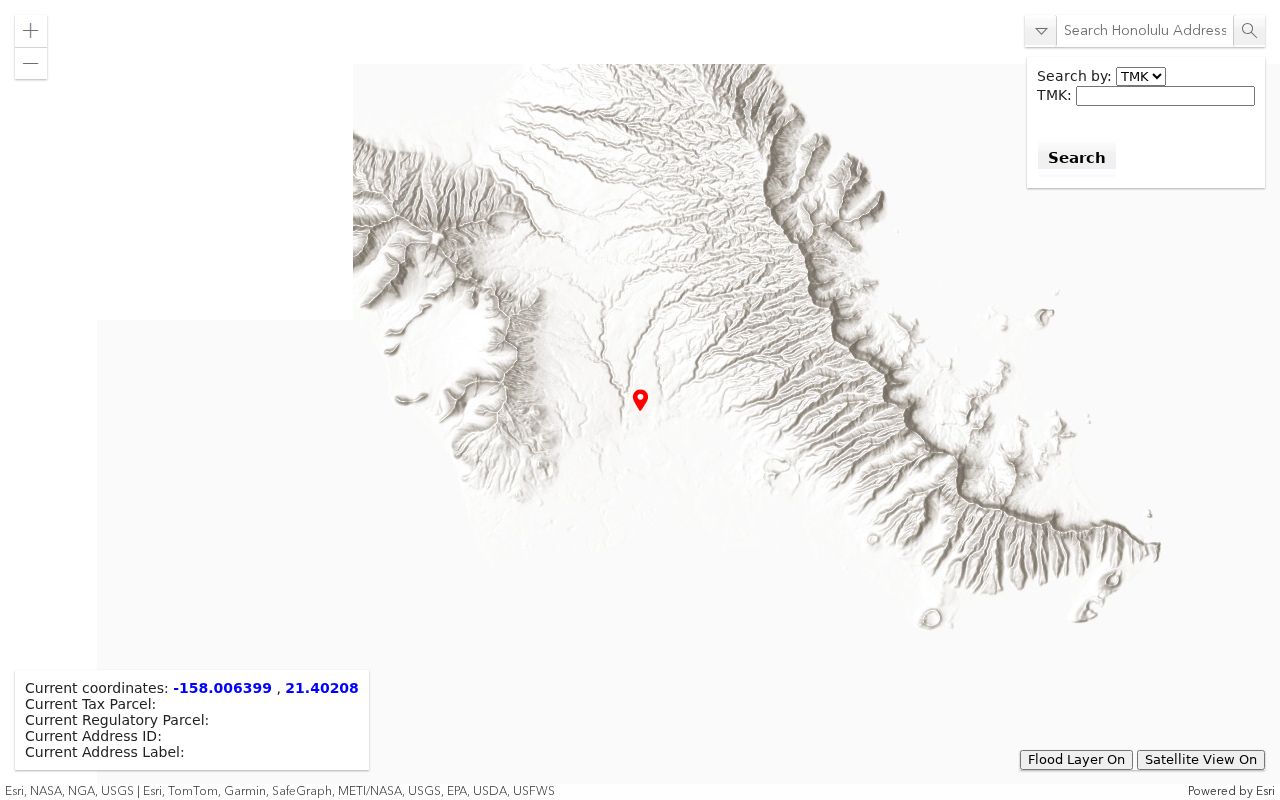
Honolulu GIS can add zoning, flood, Special Management Area, warning, and advisory layers. Those layers explain the setting around nearby parcels, but they do not reveal household identities. Exact buffer, export, and measuring tool names were not confirmed during research, so use direct parcel clicks rather than assuming an automated radius feature.
Walk Around Pearl City Parcels
One address becomes a block view through a short, repeatable flow. Keep the first pass geographic. Names come later, if an official parcel result exposes them.
- Select the target parcel and record its TMK, address label, and map scale.
- Zoom to the street segment and click each touching or facing parcel.
- Note whether each shape is a separate lot, CPR, common area, road, stream, or public facility.
- Run each adjacent TMK through RPAD for land, building, assessment, and sales context.
- Use BOC or DPP only when one chosen parcel needs a deed or permit follow-up.
This sequence avoids treating a common area or road remnant as a home. It also exposes lots that face the target across the street, which may be more relevant than parcels that touch at a rear corner. For a full named-road chain, use the Pearl City street directory rather than expanding a neighbor lookup beyond its immediate block.
Compare Pearl City Parcel Facts
The Honolulu property search verifies address or TMK access. A parcel card may show lot size, living area, building traits, present and prior assessments, classification, exemption information, and sales history. Keep situs and mailing addresses in separate columns. A matching mailing address can suggest owner occupancy, but it cannot prove who lives there now.
- Parcel
- A mapped unit of land identified for tax and record purposes.
- Situs
- The physical site address of the parcel.
- Mailing address
- The destination used for owner correspondence, which may be elsewhere.
- CPR
- A condominium property regime that can place units and common land within one project.
Assessment data is not a legal opinion of ownership. If title matters for a selected lot, use the BOC grantor-grantee index and match the TMK or legal description. Do not bulk-build a profile for the whole block.
Pearl City Permits Add Context
Permit history can make the shape of a block easier to read. Honolulu's open-data snapshot covers 2008 through June 30, 2017 and can include permit number, TMK, issue and completion dates, work type, contractor, value, and status. Additions, demolition, solar work, and other projects can explain why two nearby parcels now look different.
A permit names a project, not the people occupying a home. Current files or plans may require the DPP Data Access and Imaging Branch, HNL Build, or a request under Hawaiʻi's Uniform Information Practices Act. Agencies generally need a record described well enough to locate; UIPA does not require creation of a new block roster.
Pearl City Voters Stay Limited
HRS §11-97 makes a voter's full name, district or precinct, and status public while protecting most affidavit details. Hawaiʻi's online voter status system is credentialed for an individual's own check. It requires state identification details and the last four digits of a Social Security number. It is not a public address-to-name tool for a block.
Precinct geography is still useful. Pearl City portions cross House Districts 34 and 35 and several Senate and Honolulu Council assignments. Resolve one block against the official street and precinct material, not a ZIP or casual neighborhood label. A district boundary can cross what residents think of as one local area.
Geography check. A Pearl City postal label, census place, board area, and election district may describe different boundaries.
Pearl City Civic Neighbors
Neighborhood Board No. 21 is the strongest verified community layer. It publishes meetings, agendas, minutes, testimony, and local issues through the City Office of the Neighborhood Commission. A current official event describes an 11-member board, quorum of six, and hybrid meetings at Momilani Community Center. Topics include Sunset Memorial Park, Waiawa Stream, traffic, parks, and community events.
| Community source | Public contribution | Directory limit |
|---|---|---|
| Neighborhood Board No. 21 | Agendas, minutes, testimony, area concerns | Not a household list |
| Office of Neighborhood Commission | Board records and testimony channel | Public civic contacts only |
| Pearl City board site | Meeting and community-voice information | No member roster verified |
| Pearl City Community Association | Events referenced in board materials | No official member directory found |
| Schools and community groups | Presentations and local history | No resident or alumni roster found |
Use Honolulu's neighborhood-board records for current public material. The office lists 808-768-3710 and nco@honolulu.gov. Written testimony uses the official submission channel and is requested 48 hours before a meeting. A speaker's name belongs in its civic context, not in a personal neighbor profile.
Official Versus Compiled Neighbor Data
Commercial neighbor tools combine public filings, directory material, and marketing data. They can lag moves and join two people with similar names. Official systems are narrower, but each has a known custodian and a correction path.
| Trait | Official parcel and civic records | Commercial compilations |
|---|---|---|
| Purpose | Tax, land, permit, election, or public meeting function | Combined person or address profile |
| Proof | Confirms only the filed field and date | May infer or merge sources |
| Correction | Contact RPAD, BOC, DPP, Elections, or NCO | Service-specific process |
| Block use | Parcel-by-parcel, with limits | May overstate who currently lives there |
For Pearl City block research, the parcel map, TMK, and custodian record provide the sounder path. A person compilation should never override a protected address, a conflicting official parcel, or the absence of an occupancy record.
Privacy for Pearl City Neighbors
Adjacent parcel ownership may be public. Household members, visitors, minors, renters, utility customers, and delivery records do not become public merely because a nearby lot appears on a map. Neighborhood-board testimony can name speakers, but it should remain tied to the meeting and issue.
Hawaiʻi's Address Confidentiality Program gives eligible survivors a substitute address and mail forwarding through certified application assistants. Never try to reverse-engineer a protected location by comparing parcel, voter, or court files. The substitute address is a safety tool, not an error.
Lawful use. Learn about Pearl City neighbors and civic issues without watching, harassing, intimidating, or exposing any person.