
Pearl City ZIP Coverage
Two Census ZCTAs intersect Pearl City CDP: 96782 and 96701. ZCTA means ZIP Code Tabulation Area. The first is the strongest Pearl City postal label. The second is primarily Aiea, though official sources document Pearl City aliasing and nearby Pearl City-area use. A third number, 96861, appears in a Hawaiʻi health survey grouping for Aiea and Pearl City, but the research did not verify it as a Pearl City CDP residential ZIP. That distinction belongs at the front of any postal directory.
| ZIP Code | Areas Covered | Post Office | Notes |
|---|---|---|---|
| 96782 | Pearl City; ZCTA intersects Pearl City CDP | Verify facility through USPS | Strong postal label, not a city or election line |
| 96701 | Aiea, with documented Pearl City aliasing | Aiea Post Office, 99-040 Kauhale Street | Can serve Pearl City-area addresses |
| 96861 | Adjacent Pearl Harbor/community statistical grouping | Exact USPS tie not verified | Do not call it a Pearl City CDP ZIP |
The Census profile describes roughly 9.1 square miles of land, but a ZCTA intersection is neither a postal boundary nor a city limit. Pearl City's local geography also includes Waiau, Waiawa, Manana, Lower Pearl City, the peninsula, shoreline, and residential ridges. Postal routes, neighborhood labels, planning areas, census tracts, and political districts slice that landscape in different ways. Always describe 96701 and 96782 as serving or intersecting the area, then let USPS decide the ZIP for an exact address.
Pearl City ZIP 96782
Official Census and Hawaiʻi health sources connect 96782 with Pearl City. It is the safest general label for the community, yet it still follows postal routing rather than the Pearl City CDP edge. An address bearing 96782 may fall outside a selected Neighborhood Board, House district, council district, or census tract. The ZIP alone cannot prove any of those assignments.
The postal facility address for 96782 was not isolated in the official research. Do not fill that gap with an assumed station. Instead, enter the full street address in the USPS lookup and use the returned postal city and ZIP. This approach also catches unit designators and address formatting that a broad directory may miss.
Aiea 96701 Meets Pearl City
ZIP 96701 is officially labeled Aiea in the cited sources. A USPS bulletin also documents Aiea and Pearl City aliasing, which explains why a Pearl City-area lead may carry an Aiea postal city. The Aiea Post Office is at 99-040 Kauhale Street, Aiea, HI 96701-9998. A searcher should not reject an otherwise sound parcel or directory match merely because the mailing line says Aiea.
Local planning adds context. The Aiea-Pearl City planning area reaches from Halawa Stream toward Pearl City Industrial Park, with Pearl Harbor to the south and ridges to the north. That planning area is useful for local context, but it is not the USPS service map. This overlap is a key finding for the Pearl City postal directory.
Note: Preserve the postal city exactly as USPS returns it, even when a neighborhood or common local label differs.
Why 96861 Needs Caution
Hawaiʻi Department of Health material groups 96861 with Aiea and Pearl City for one community survey purpose. That grouping is statistical. The official sources inspected did not tie 96861 to the Pearl City CDP through a USPS city-and-ZIP page. The Census profile's intersecting ZCTAs were 96701 and 96782.
Use 96861 only when an exact address returns it through USPS or when describing the source's own community grouping. Never promote it to a general Pearl City residential ZIP on the strength of the health grouping alone. This careful treatment avoids turning a research category into a postal claim.
Find Pearl City Records by ZIP
Most official Pearl City systems work better with a full address or TMK than with a ZIP-wide query. USPS confirms the routing answer. Honolulu Real Property Assessment Division searches by site address or TMK. HoLIS selects parcels by address, TMK, or point of interest. Election offices use a street and precinct index rather than an open ZIP roster. A broad ZIP is therefore the first cut, followed by a more exact key.
- Enter the complete address in the official USPS lookup. Save the returned ZIP and postal city exactly.
- Search RPAD by site address or TMK. Record the parcel's situs address, separate tax mailing address, and TMK.
- Confirm the parcel through HoLIS, then consult the street and precinct index for election geography.
- For an old address, compare directories, plats, legal descriptions, and historic maps before assuming today's ZIP applies.
Once a ZIP has narrowed the area, the Pearl City street directory explains the address and parcel route in full. That separation prevents a ZIP-wide search from being mistaken for a list of occupants.
USPS Confirms Pearl City ZIPs
The USPS ZIP Code Lookup is the final postal check for a complete address. Supply the house number, street, unit when known, city, and state. The result answers how mail is routed. It does not establish who lives there, who owns the parcel, which census place contains it, or which election district applies.
The official USPS interface shows why the address, not the neighborhood name alone, is the right input.
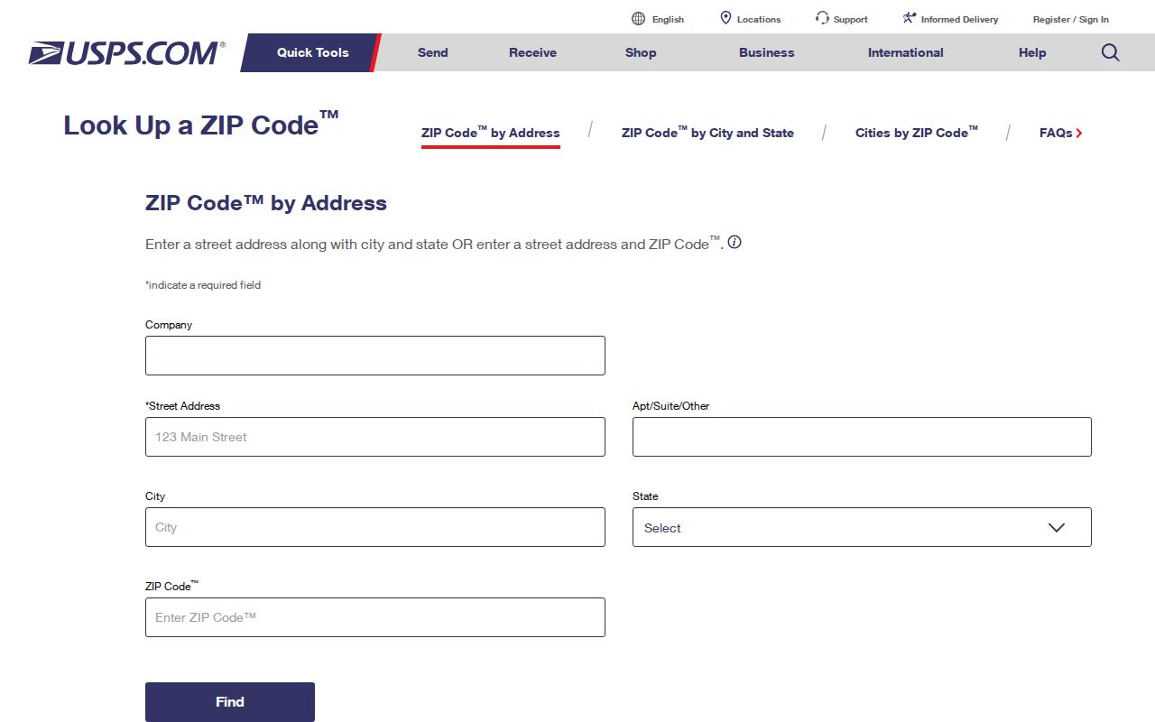
Save the returned ZIP and city label before checking county parcel or election records.
Pearl City ZIP Search Systems
The local systems do not share one reliable ZIP field. RPAD's legacy navigation showed an advanced ZIP control, but the current filter and result limit were not captured. HoLIS has address, TMK, and point-of-interest selection, with no verified ZIP filter. DPP permit data uses TMK and address. The Office of Elections provides street and precinct information, not a public ZIP resident roster.
| System | Verified search key | What it returns |
|---|---|---|
| USPS | Full address or ZIP lookup | Postal ZIP and city |
| Honolulu RPAD | Address or TMK | Assessment and parcel record |
| HoLIS | TMK, address, or point of interest | Parcel map and geographic layers |
| Office of Elections | Address or street/precinct table | Election geography, not a resident roster |
| Historical directories | Name or street | Period address entry, often from before ZIP use |
Do not invent a ZIP-wide result when the official portal does not document one. Move from postal ZIP to address, then to TMK or precinct. That chain gives each custodian the key it actually uses.
Older Pearl City Addresses
Pearl City's address history predates modern ZIP searching. Oahu Railway & Land Co. planned the Manana subdivision in 1890, and Lehua Avenue linked Government Road, now Kamehameha Highway, toward the peninsula. Official planning and highway sources preserve maps and aerial views from 1890, 1922, 1928, 1952, 1959, and 1970. H-1 construction changed road and parcel relationships.
No official street-renaming or renumbering schedule was found. For an older record, compare the publisher's street form with a plat, BOC legal description, TMK, and period map. Directories may abbreviate streets, omit people, or use a number that later changed. A modern ZIP should not be pasted onto a 1900 address without proof.
The 2012 Honolulu Neighborhood Commission street index links street ranges with area and ZIP, but it is historical. Use it as a dated crosswalk, not as today's USPS authority.
Pearl City ZIP Boundary Mismatches
Pearl City has no incorporated city limit. It is a Census-designated place within the consolidated City and County of Honolulu. The Pearl City CDP, postal delivery area, Neighborhood Board No. 21, census tracts, House Districts 34 and 35, Senate districts, and council areas all use different lines. A 96782 address may sit outside one chosen civic boundary. A Pearl City-area parcel may use Aiea and 96701.
Parcel questions belong to RPAD and HoLIS. Postal questions belong to USPS. Election assignments belong to the Office of Elections and County Elections Division. Census questions use CDP, tract, or ZCTA geography. Keeping those roles apart is the main rule of the Pearl City postal directory.
- ZIP vs ZIP+4
- A five-digit routing area versus a more precise delivery segment added after a hyphen.
- PO-box ZIP
- A code used for post-office boxes rather than a general street-delivery area.
- Unique ZIP
- A ZIP assigned to one large organization or site.
- Carrier route
- The smaller delivery path followed by a postal carrier within a ZIP.
Boundary check. A Pearl City postal code is a mail route, not proof of CDP residence, parcel ownership, neighborhood membership, or election district.